Geospatial Map Gallery
All maps by Dustin Littlefield
About This Gallery
This gallery presents a curated selection of cartographic and geospatial analysis work, highlighting thematic mapping, spatial modeling, and data visualization techniques developed through GIS and remote sensing workflows of my indiviudal projects. Clicking an image will take you to the map in its context of the full report.
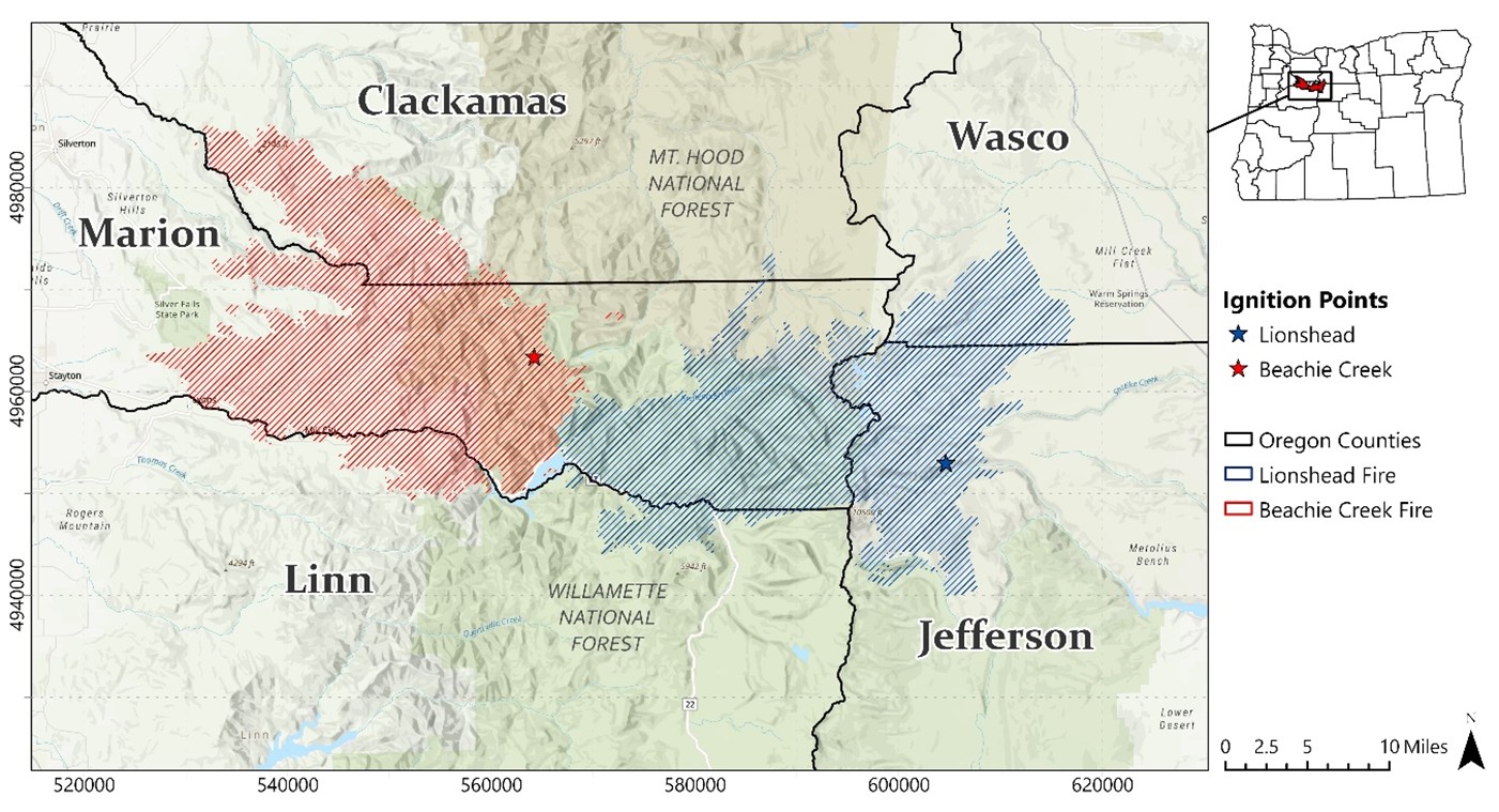
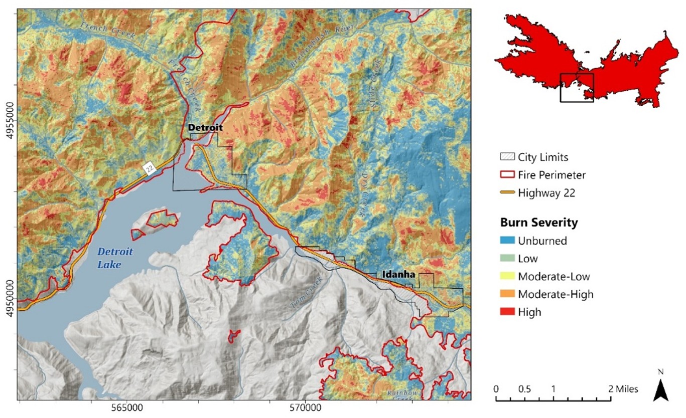
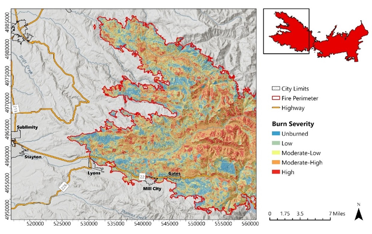
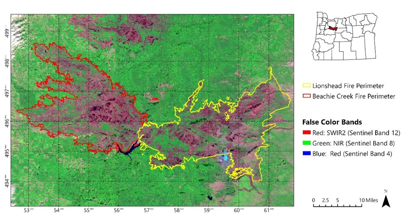
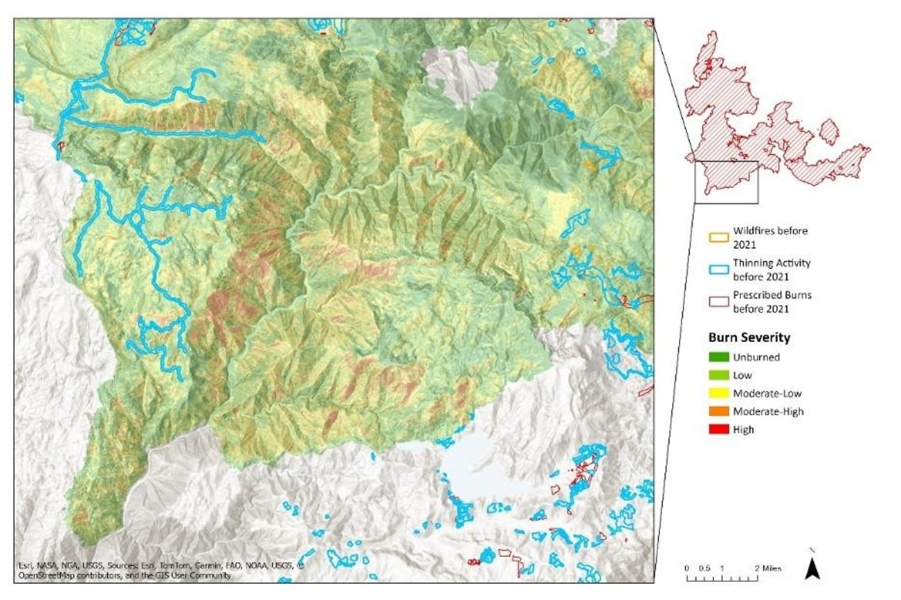
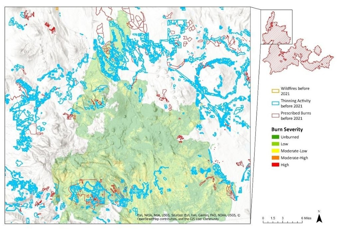
Beachie Creek–Lionshead Complex Fire, Oregon 2020
Summary: A multi‑sensor wildfire assessment using Sentinel‑2 imagery to compute NBR, dNBR, NDVI, and false‑color composites, classify burn severity, and evaluate species‑specific vegetation mortality across the Cascade Range.

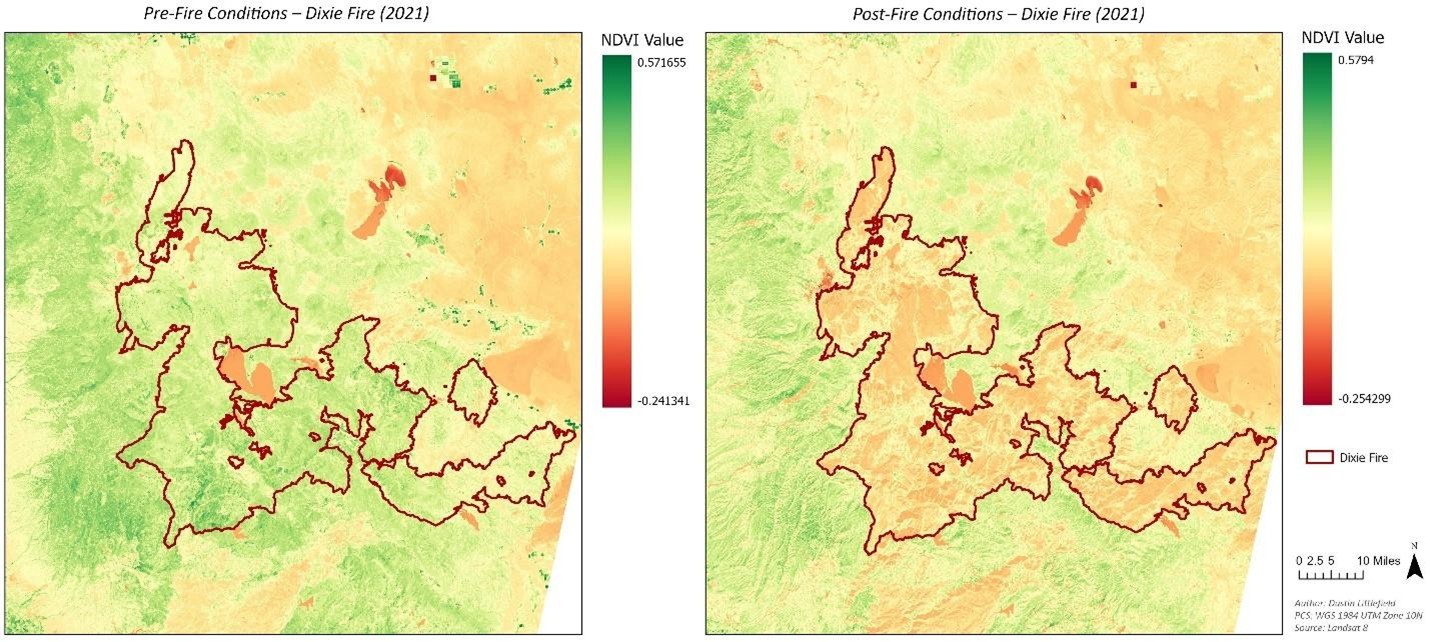
Dixie Fire, California 2021
Summary: A Landsat‑8–based burn severity workflow applying NBR/dNBR, pre‑/post‑fire spectral comparison, and USGS severity thresholds to quantify vegetation loss and landscape‑scale fire impacts.
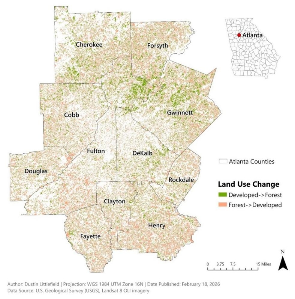
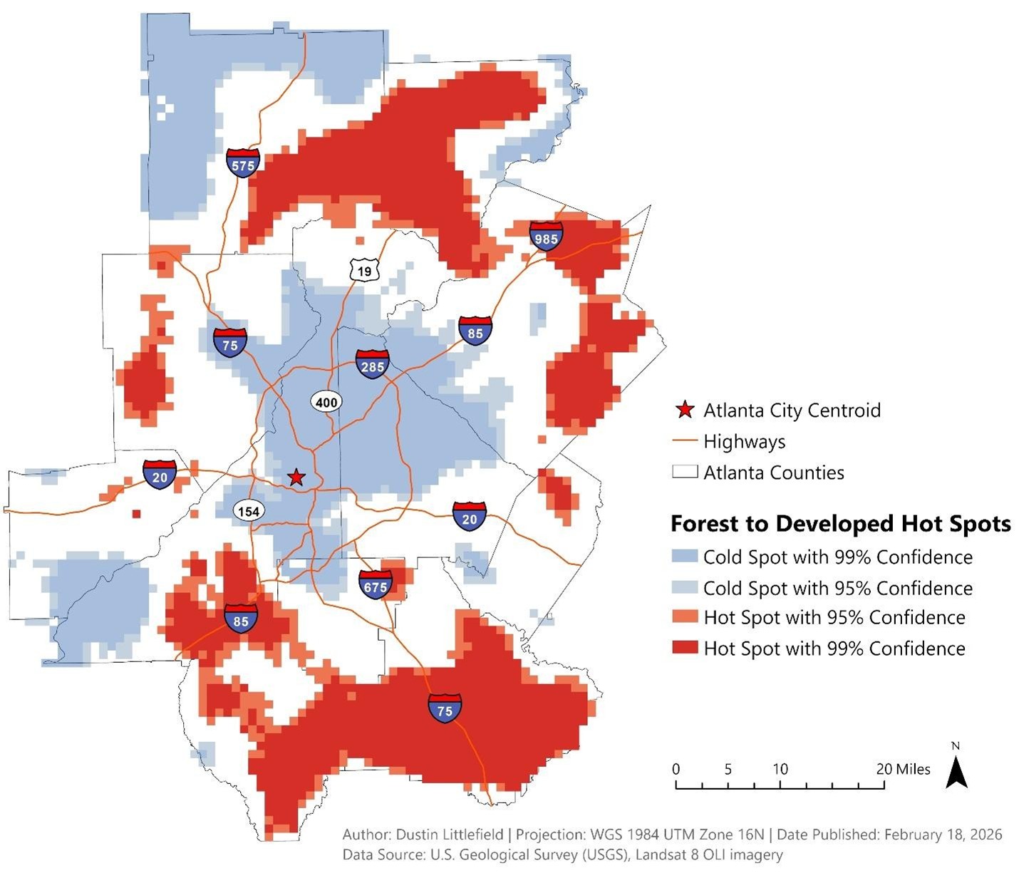
Atlanta Metropolis Region 2000–2020
Summary: A two‑decade land‑cover change detection analysis using Landsat imagery, supervised classification, and spatial metrics to map urban growth patterns and quantify development across the Atlanta metropolitan region.
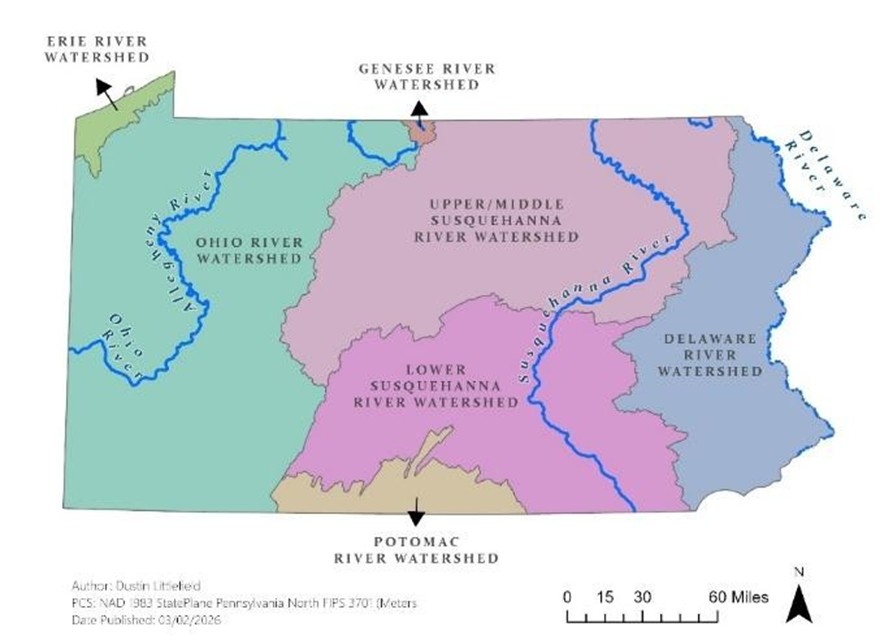
Pennsylvania Hydrology 2024
Summary: A machine‑learning hydrology project integrating watershed variables, climate predictors, and USGS streamflow records to train and evaluate regression models for short‑term flow forecasting.

Story Maps
Archived Maps
Tools & Techniques Used
- ArcGIS Pro
- QGIS
- Python (geopandas, matplotlib, rasterio)
- Remote Sensing & DEM analysis
- Cartographic Design & Layout Styling
Contact
Dustin Littlefield
based in Oregon, USA
LinkedIn
Email: dustinlit@gmail.com
License
© 2026 Dustin Littlefield • Environmental Data Science & Remote Sensing